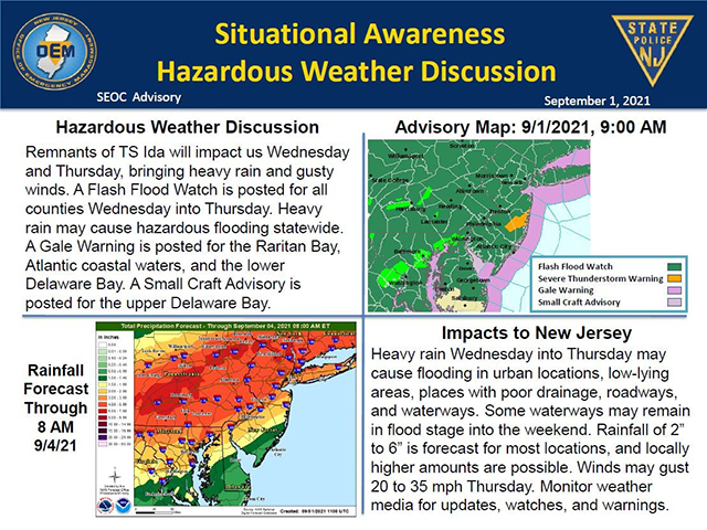
Flash Flood Watch in Effect Through Thursday as Remnants of Tropical Storm Ida Impact Area
Posted September 01, 2021Remnants of Tropical Storm Ida are expected to impact our area Wednesday and Thursday, Sept. 1 and 2, bringing heavy rain and gusty winds. The National Weather Service has issued a flash flood watch for coastal New Jersey, New York City, Long Island, and Connecticut through Thursday afternoon. Heavy rain may cause hazardous flooding statewide, especially in low-lying areas, places with poor drainage, roadways, and waterways. Some waterways may remain in flood stage into the weekend.
Between 6 and 9 p.m. Wednesday a period of torrential rain is forecast to move in with extremely heavy rates. This period of torrential rain is anticipated to continue through the evening before lightening up and tapering off after midnight. Significant flooding problems may occur towards and after sunset as this torrential rain produces several inches of rain over a short period of time.